While my friend from Montana was here, we decided to visit the local Museum of Western Colorado (though actually I think they renamed it recently to something more self important and pretentious). It's not a huge museum, but they have a pretty darn good gun collection.
Everything from old muzzle loaders to lever actions to sawed off contraptions used by outlaws such as Butch Cassidy.
One of the more interesting guns is a Smith and Wesson lever action pistol. If I understand correctly, this is what S&W, while still called Volcanic Repeating Arms, got started on.
And one of the most "historical" guns is this revolver, which was owned by Alfred Packer (see the AP carved into the front of the grip?) In case you didn't know, ol' Al was Colorado's own (alleged) cannibal, and who those wacky hippies at University of Colorado in Boulder named the school cafeteria after.
This display, though, was my favorite, showing the guns used by every Mesa County Sheriff--from single action revolvers all the way up to Glocks. Most interesting to me were the two guys in the middle who used a couple variants of the proto-1911. Unfortunately my memory and the photo are too blurry to tell what the museum says the exact models were, but I think the one was a Colt Model 1890[something] and the second was a Colt Model 1900[something]. Anyone out there who thinks they can tell, please comment!
They usually have the Gatling Gun that was at Ft. Crawford, but apparently it was out the day we visited. Despite that, it was a very enjoyable way to spend a morning.
10/04/2011
Happy birthday to me...
Nothing like another hash mark on the wall to make you think about your slim prospects. Woooo.
10/03/2011
Photodump: hiking around Ouray
Specifically, we hiked the Albany Loop and Hendrick Spur, which is about 5 miles total, but with a few thousand feet going up and a few thousand coming down. Once again, we hit the area at a just perfect time; the weather was shirtsleeve-pleasant with just a few sprinkles, and all the aspens were turning colors.
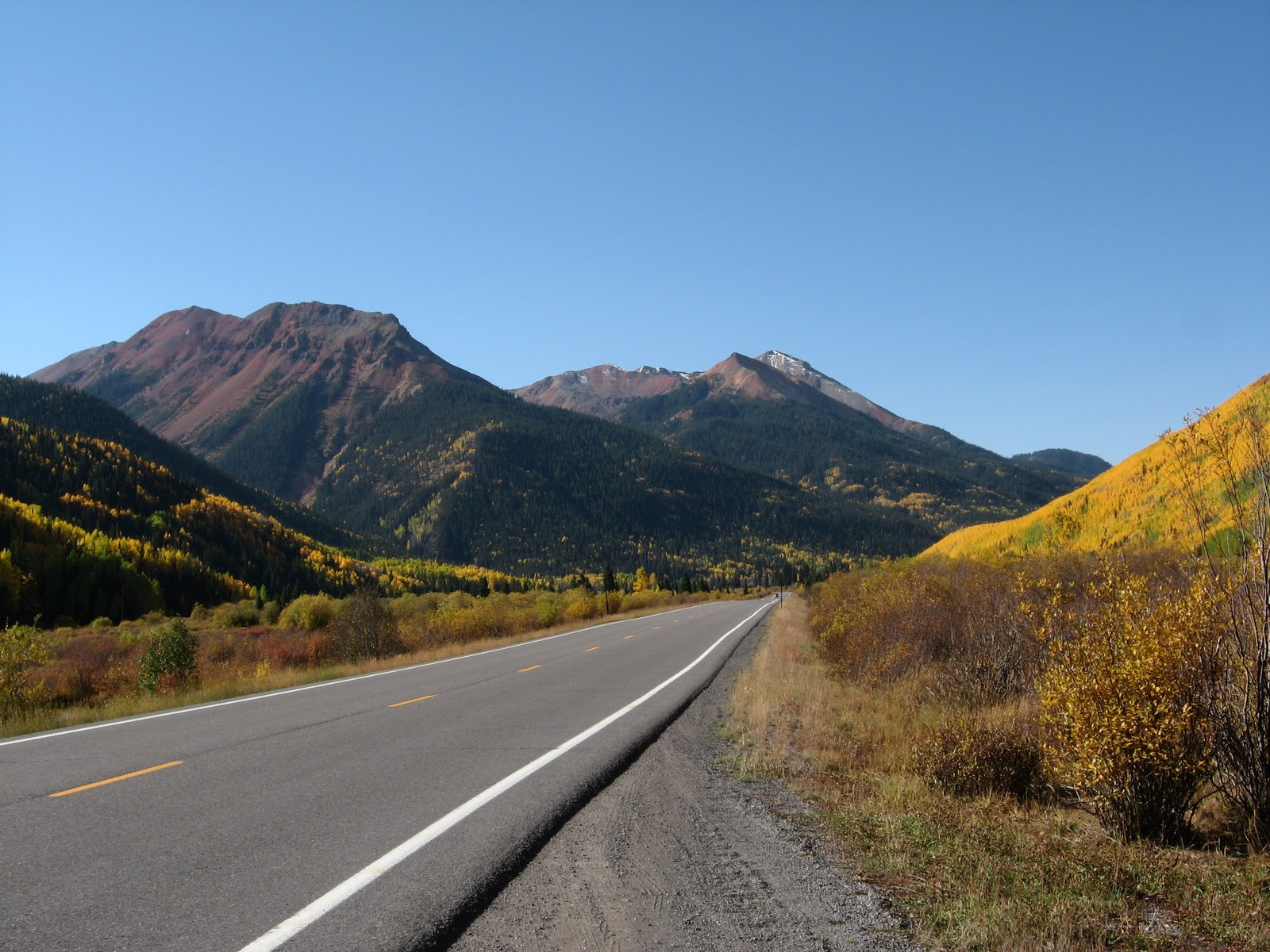
From where the truck was parked next to Crystal Lake, looking towards the imaginatively named Red Mountain.
The obligatory "looking up at the trees" picture.
Yellow carpet.
View of Red Mountain from the Hendrick Spur.
View of the road from the top of the Hendrick Spur--it sure doesn't look as far as what it feels it should be after that hike up the side of the canyon. It blows my mind that we were right at three or four mines... how the heck did those old timers get supplies up the side of that cliff without dropping it all down the side?
And a view from the road back up to where we were at the aforementioned mines.
Red mountain, again, and with red aspens to go with it.
An old building from the Ironton ghost town site, which is south of where we hiked but still north of Red Mountain Pass. Apparently in the late 1800's until the silver bust, Ironton had 300 buildings.
And that is the Yankee Girl mine, which was the richest silver mine in the area. According to the helpful roadside signs, the ore from this mine was so rich that they could skip the condensing stage and go straight to the smelter.
All told, in just this area between Ouray and Silverton, there were somewhere around 100 mines, and about 3000 people making a living, mostly going after silver. Adjusted for inflation, billions of dollars worth of silver came out of the ground here. But when the US demonetized silver, it pretty much killed the silver mines. Some of the mines had other metals and lived on, but the boom times were definitely over.
Oh, and noodling around on Wikipedia I saw that Ouray was the area that Ayn Rand modeled Galt's Gulch on. Ya learn something new every day.
From where the truck was parked next to Crystal Lake, looking towards the imaginatively named Red Mountain.
The obligatory "looking up at the trees" picture.
Yellow carpet.
View of Red Mountain from the Hendrick Spur.
View of the road from the top of the Hendrick Spur--it sure doesn't look as far as what it feels it should be after that hike up the side of the canyon. It blows my mind that we were right at three or four mines... how the heck did those old timers get supplies up the side of that cliff without dropping it all down the side?
And a view from the road back up to where we were at the aforementioned mines.
The little river running through the valley is yellow-red, and doesn't have any aquatic life. According to the signs alongside the road, that's natural for this area (Red Mountain is red because of how iron-rich the rock is, and it affects everything else) and not because of any mine runoff--though they do mention the mines didn't help anything. I wouldn't want to drink it, at least.
An old building from the Ironton ghost town site, which is south of where we hiked but still north of Red Mountain Pass. Apparently in the late 1800's until the silver bust, Ironton had 300 buildings.
And that is the Yankee Girl mine, which was the richest silver mine in the area. According to the helpful roadside signs, the ore from this mine was so rich that they could skip the condensing stage and go straight to the smelter.
All told, in just this area between Ouray and Silverton, there were somewhere around 100 mines, and about 3000 people making a living, mostly going after silver. Adjusted for inflation, billions of dollars worth of silver came out of the ground here. But when the US demonetized silver, it pretty much killed the silver mines. Some of the mines had other metals and lived on, but the boom times were definitely over.
Oh, and noodling around on Wikipedia I saw that Ouray was the area that Ayn Rand modeled Galt's Gulch on. Ya learn something new every day.
10/02/2011
Car Camping
This picture should tell you all you need to know why the eating is better car camping than backpacking:
That's bacon and a tomato and kale from the garden on some of that cheese-jalapeno bread. At a campsite with this view:
10/01/2011
Don't Worry
We're back. No mountain lion attacks, no government raids, no vehicular maleficence, and no time (yet) to stop and think. My Montana friend is going back tomorrow, after a vacation well spent. We basically have hit all four cardinal directions from town--just enough of a teaser that I hope he gets down here again for a trip with more substance.
And tonight for desert there was local mead, peach pie (from local peaches), brownies (not from local anything), and root beer floats (with root beer from one of the local microbreweries). Thus negating any beneficial effects from that 5-mile hike that went 1,800 feet up the side of a canyon wall to a few old silver mines.
Subscribe to:
Posts (Atom)